
Shkhara Glacier: The Hike to Georgia's Highest Peak from Ushguli
The Shkhara Glacier descends from the southern face of Mount Shkhara — at about 5,193 meters, Georgia's highest peak — into the upper Enguri valley above Ushguli, in the Svaneti region of Georgia (the country in the South Caucasus). Its terminus is reached on foot up the valley from the village, and it's one of the more accessible glacial environments in the Greater Caucasus, needing no technical equipment or mountaineering experience. The combination of the glacier, the immense mountain wall at the head of the valley, and the wide-open approach makes it one of the most rewarding walks from Ushguli — and for travelers who've already made the effort of reaching Ushguli, one of Europe's more remote inhabited places, it extends the high-Svaneti experience into terrain the village itself, for all its character, can't offer.
What is the Shkhara Glacier hike?
The Shkhara Glacier hike runs up the Enguri valley from Ushguli to the foot of the glacier beneath Mount Shkhara, Georgia's highest peak (~5,193 m), in Upper Svaneti. Along with the Chalaadi Glacier near Mestia, it's one of the only Caucasus glaciers reachable on an easy day hike — no technical skill required. The full walk is about 14–16 km round trip and takes roughly 5–6 hours, mostly flat along the valley floor with a short climb to the ice at the end (terminus around 2,390 m, where the Enguri River is born). It can be shortened to about 2–3 hours by taking a 4WD jeep or a horse part-way up the valley — the common choice for day-trippers from Mestia. The glacier is the dramatic source of the Enguri, and the walk is mostly about the experience of the valley and the great south wall of Shkhara at its head.
The mountain and the glacier
Mount Shkhara dominates the upper Enguri valley — its southern face a wall of rock, ice, and snow that fills the head of the valley and defines the northern horizon of Ushguli. It's part of the main divide of the Greater Caucasus, forming a stretch of the border between Georgia and Russia, with extensive glaciation across its summit plateau and ridges. Shkhara is one of the more technically demanding peaks in Georgia to summit — complex glacier terrain, serious objective hazard from ice and rockfall on the upper mountain, and the altitude challenges of any Caucasus 5,000-meter peak. The walk from Ushguli reaches nowhere near that world; it goes only to the glacier terminus, not into the serious mountaineering ground above. But the proximity of that world, visible overhead in clear weather, gives the hike a scale and context that lower walks elsewhere in Georgia can't match.
The Shkhara Glacier itself is one of the longer glaciers in the Georgian Caucasus, fed from the accumulation zones of the high plateau and descending through icefalls and flatter sections to its terminus in the valley above Ushguli. Like glaciers everywhere, it has retreated markedly over the past century — the moraines of earlier, more extensive positions are visible as ridges and mounds of debris well below the present front, a tangible record of how much ice has been lost. The current terminus is an active glacial front where the proglacial river emerges from beneath the ice, the grey-blue of glacier ice showing where the surface is exposed. The terminus position and the amount of visible ice vary with the season and recent weather, but in the main summer months the glacier is clearly visible and the approach brings you close enough to take in its scale and character.
The walk
The route follows the Enguri valley upstream from Ushguli, on a jeep track and paths along the valley floor, moving from the alpine meadows around the village (you'll pass grazing horses and cattle) through progressively more glacial terrain — boulder fields, moraine, the braided channels of the proglacial river — as the valley narrows and bends toward the glacier. It isn't a formally marked trail, but it's easy to follow in good visibility: the valley topography points you straight toward the head, and there's nowhere really to get lost (you'll cross a few small streams). The ground changes underfoot — grass and soft ground near the village giving way to rough moraine and river gravel near the ice — so footwear with grip and reasonable ankle support is worth having.
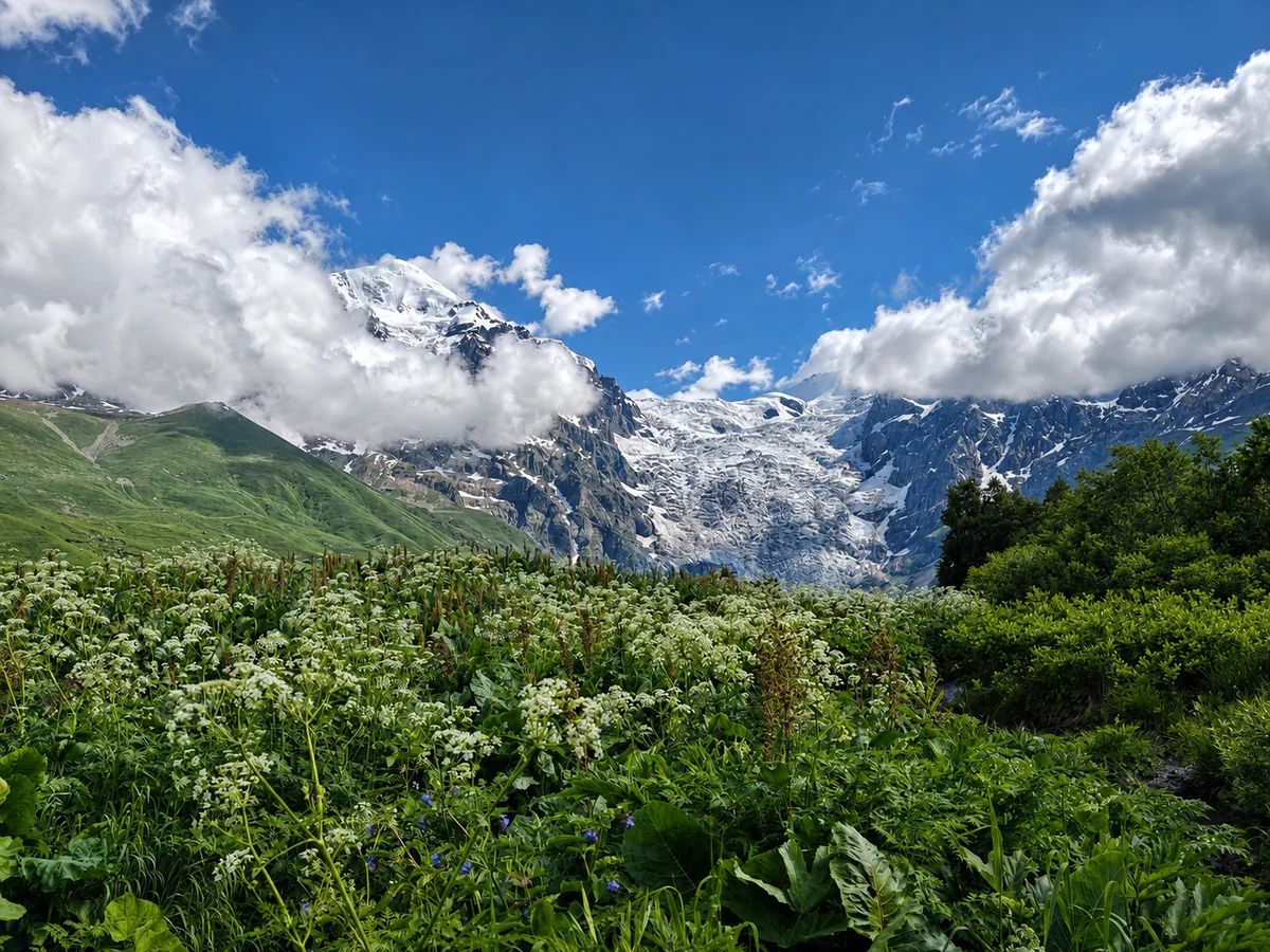
The full walk is about 14–16 km round trip and takes most people roughly 5–6 hours, with moderate, gradual elevation gain rather than steep climbing — the valley floor rises slowly, with a short climb to the ice at the end. Crucially, the walk can be substantially shortened: jeeps run part-way up the valley (parking at a point from which you continue on foot over the final moraine), and horseback trips are easy to arrange in Ushguli — either option cuts the glacier visit to roughly 2–3 hours, which is how most people doing it on a day trip from Mestia manage it. There's a small café/snack bar partway up the valley (by a bridge, where jeeps park) for a rest.
The views improve as the valley narrows and the surrounding peaks rise above the walls. Shkhara dominates the head of the valley from early on, but the full scale of its southern face — the ridges, the hanging glaciers, the ice cliffs where sections break away — only becomes comprehensible as you move deeper in and the angle opens upward. In clear conditions the blue sky against the white and grey of the upper mountain has a visual intensity hard to anticipate from photographs, and the silence of the upper valley — broken only by the river, the occasional crack of ice, and the wind — gives the walk a focused quality the busier sites of Georgia can't.
At the glacier
At the terminus, the shift from the living valley to the geological world of the ice is immediate. The proglacial river emerges cold and grey-green with glacial flour — the fine rock ground from the valley walls by the moving ice — and the air turns noticeably colder near the ice mass. The glacier's sounds are audible up close: meltwater moving, the occasional crack or groan of ice under its own weight, and in warm weather the steadier sound of surface melt running off the ice. Not the dramatic calving of a sea-front glacier, but the sounds of a living geological process, giving the terminus a quality of active presence the static grandeur of the mountain above doesn't convey in the same way.
A safety note for the terminus: as at any glacier front, keep a sensible distance and take care — rockfall is a real hazard here, with rocks of all sizes coming down across and from the glacier without warning. Don't climb onto the ice or linger directly beneath the front or the loose moraine slopes. The moraine you walk on for the final approach — rock, gravel, and debris left as the ice retreated — is stable enough but uneven, and slippery after rain; among it you'll find boulders faceted and scratched by their transit within the ice, a whole range of rock types carried down from across the mountain, like a geological collection assembled by the glacier.
Weather and conditions
The upper Enguri valley is subject to the rapid weather changes of the high Greater Caucasus, and conditions can shift significantly between leaving Ushguli and returning. Clear mornings often give way to cloud over the peaks by midday, and summer afternoon thunderstorms are common — bringing lightning, rain, and a sharp temperature drop to exposed valley terrain that offers no shelter. Start early — by 7 or 8 am, when conditions are usually most settled — for the best chance of reaching the glacier in clear weather and returning before the afternoon turns; and remember the full walk is a 5–6 hour commitment, so an early start matters. Turning back in deteriorating weather is always the right call, however close the glacier looks.
The glacier is reachable from roughly June through October, with July, August, and September the most reliable for clear conditions and snow-free terrain. Early June may have residual snow on the approach depending on the winter; October brings the first autumn snowfall (and beautiful autumn color) but can affect the route late in the month. Midsummer also shows the glacier at its clearest, once the winter snow that obscures the surface in spring has melted to expose the blue-grey ice.
Combining with Ushguli
The glacier walk fits naturally into a stay of a night or two in Ushguli — the visit structure that does most justice to both the village and the valley. With the Mestia–Ushguli road now paved (since 2024), cutting the drive to about 1.5–2 hours each way, and with the jeep/horse option to shorten the valley approach, a glacier visit is feasible on a longer day trip from Mestia — but it's tight, and an overnight is far better: it lets the glacier take one morning or afternoon while Ushguli's towers, the Ethnographic Museum, and Lamaria Church fill the rest, for a complete experience of the upper Enguri valley at its best.
Getting there and visiting
- Location: Up the Enguri valley above Ushguli, Mestia Municipality, Upper Svaneti, Georgia; terminus around 2,390 m, beneath Mount Shkhara (~5,193 m).
- The walk: ~14–16 km round trip, ~5–6 hours, moderate/gradual; or ~2–3 hours if shortened by 4WD jeep or horse part-way up the valley.
- Getting to Ushguli: From Mestia (~45 km), about 1.5–2 hours on the road paved in 2024, by shared marshrutka or private taxi; Ushguli is also the endpoint of the multi-day Mestia–Ushguli trek.
- Essentials: Sturdy footwear, warm and waterproof layers, sun protection, food and water. Start early. Keep a safe distance from the glacier front (rockfall).
- Best time: June–October (July–September most reliable).
- Admission: Free.
- Combine with: Ushguli itself — the Svan towers, Lamaria Church, the Ethnographic Museum, and the ruined Queen Tamar's Castle.
Caucasus Travel FAQ
It's a walk up the Enguri valley from Ushguli to the foot of the Shkhara Glacier, beneath Mount Shkhara — Georgia's highest peak at about 5,193 meters — in Upper Svaneti. Along with the Chalaadi Glacier near Mestia, it's one of the only Caucasus glaciers reachable on an easy day hike, needing no technical skill. The glacier is the source of the Enguri River, and the walk is mostly along the open valley floor with the great south wall of Shkhara filling the head of the valley.
The full walk is about 14–16 km round trip and takes most people roughly 5–6 hours — mostly flat along the valley with a short climb to the ice at the end (terminus around 2,390 m). It's not technical, but it's a real half-to-full-day walk, not a short stroll. You can shorten it considerably — to about 2–3 hours — by taking a 4WD jeep or a horse part-way up the valley, which is how most people visiting on a day trip from Mestia do it. Either way, start early and be off the exposed valley before the afternoon weather.
The walk itself is moderate and non-technical — the valley floor rises gradually — so it suits anyone with reasonable fitness in proper footwear. The main cautions are the weather and the glacier front. The upper valley is fully exposed, with frequent summer afternoon thunderstorms (lightning, rain, sharp cold) and no shelter, so start early and turn back if conditions deteriorate. At the glacier itself, keep a safe distance: rockfall is a real hazard at the front, with rocks coming down across the ice without warning, so don't climb onto the ice or stand directly beneath the front.
It's possible now, though still tight. The Mestia–Ushguli road was paved in 2024, cutting the drive to about 1.5–2 hours each way, and you can shorten the valley approach to the glacier to 2–3 hours by jeep or horse — so a day trip taking in both Ushguli and the glacier is feasible. But it's a full, rushed day, and staying a night (or two) in Ushguli does both the village and the glacier far more justice: the glacier can take one morning or afternoon while the towers, Lamaria Church, and the Ethnographic Museum fill the rest.
June through October, with July, August, and September the most reliable for clear weather and snow-free terrain. Early June may still have snow on the approach depending on the winter; October brings the first autumn snow (and lovely autumn color) but can affect the route late in the month. Midsummer shows the glacier at its clearest, once the winter snow covering the surface has melted to reveal the blue-grey ice. Whenever you go, the valley is exposed to fast-changing mountain weather, so carry warm and waterproof layers and start early.