
Juta and the Chaukhi Massif, Kazbegi: The "Georgian Dolomites"
Juta is a small mountain village in the Kazbegi district of northern Georgia — the country in the South Caucasus — sitting at about 2,200 meters in a high alpine valley surrounded by some of the most dramatic rocky terrain in the Caucasus. It's roughly 15 kilometers from Stepantsminda by road, separated from it by a mountain route that takes thirty to forty minutes to drive, dropping into one valley before climbing into another — a geographical separation that gives Juta a real sense of remoteness despite its accessibility. The village itself is small and traditional, a handful of wooden guesthouses and mountain cafés in a wide alpine meadow, but the landscape around it is the reason people come from across Georgia and beyond: the Chaukhi Massif, whose serrated rocky peaks rise directly above the valley to the south and east, is one of the most visually impressive mountain environments in the entire region.
The comparison to the Dolomites of northeastern Italy — which Juta's reputation has made widely circulated — isn't arbitrary or merely promotional. The Chaukhi Massif shares with the Dolomites the specific character of pale-toned sedimentary rock eroded into vertical faces and razor-edged ridgelines, rather than the rounded glaciated forms of granite or the ice-draped profiles of the highest Caucasus peaks. The result is a landscape of acute angles, dramatic shadows, and an almost architectural quality of form that sets it apart from Georgia's other famous mountain environments — Mount Kazbek's glaciated dome, Ushba's ice-streaked twin summits, Svaneti's rounded highland meadows — and gives Juta its distinct visual identity.
What is Juta known for?
Juta is a high mountain village (about 2,200 m) in the Kazbegi region, known as the gateway to the Chaukhi Massif — a striking range of pale, jagged peaks often called the "Georgian Dolomites." It's one of Georgia's premier hiking bases: an easy valley walk leads to the foot of the Chaukhi peaks, while the demanding Chaukhi Pass (about 3,341 m) crosses into the remote Khevsureti highlands toward Roshka and the colored Abudelauri Lakes. The village has family guesthouses and camping, and is home to the Khevsur mountain people.
The Chaukhi Massif
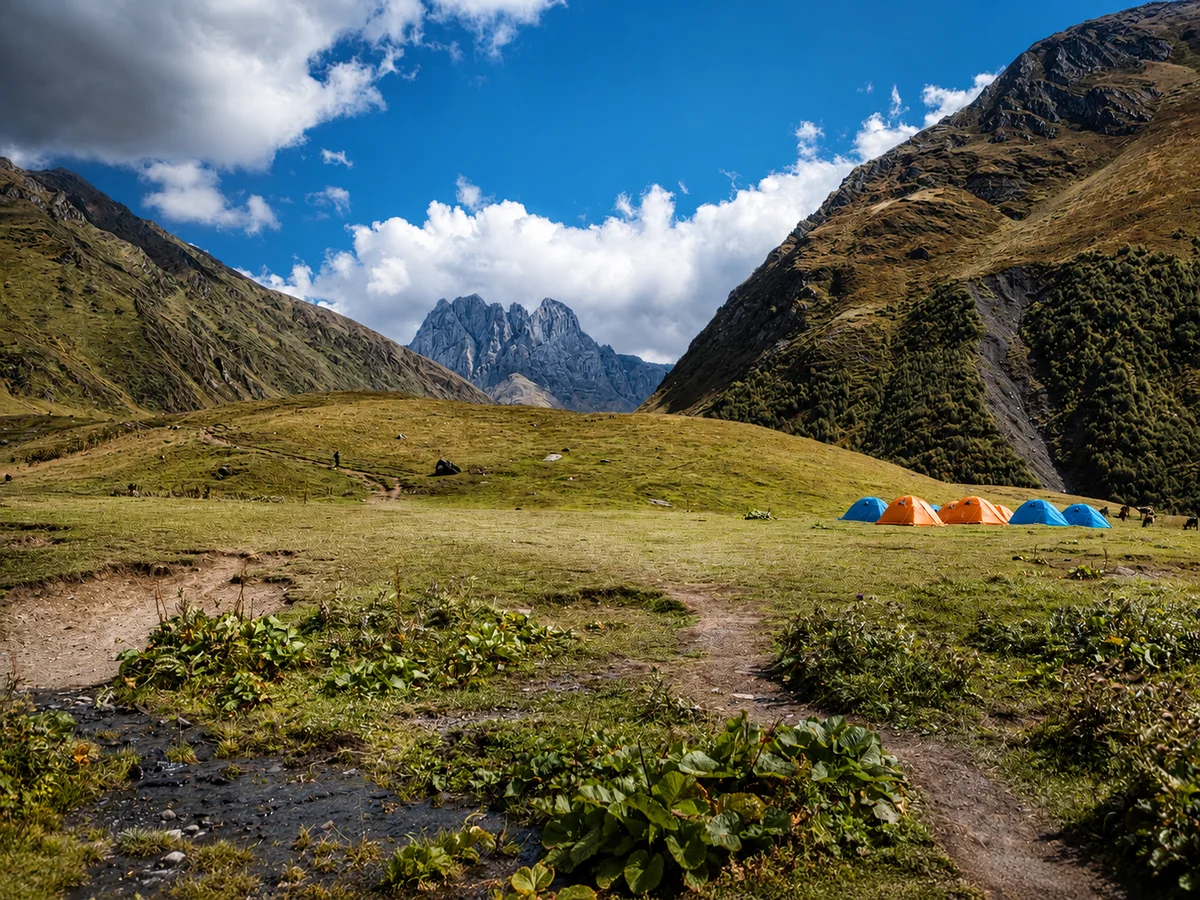
The Chaukhi peaks form the southern horizon of the Juta valley, their rocky faces rising from the alpine meadow in a sequence of towers and buttresses that changes continuously as the light moves across them through the day. Morning light catches the east-facing cliffs first, warming the pale rock to amber while the valley below is still in shadow. By midday the vertical faces reflect a flat, glaring light that emphasizes their scale. In late afternoon the west-facing sections glow while the east falls into shadow, and the full profile of the massif — the individual towers and the gaps between them, the snowfields in the higher couloirs, the glacier-fed streams descending from the base of the rock — stands out in a light that makes the evening hours the most photographically rewarding of the day.
The highest point of the massif, Mount Asatiani, reaches about 3,842 meters, and the massif's seven sharp peaks and technical rock faces have made it a destination for serious climbers from the Caucasus and internationally. The standard hiking routes don't approach the technical terrain — they cross the meadows and moraine at the base of the massif — but the visual proximity of serious climbing territory gives the hiking at Juta an intensity of alpine atmosphere that gentler environments can't match.
Hiking in the Juta valley
The principal day hike from Juta follows the valley floor toward the Chaukhi Massif, crossing meadows and river crossings on a trail that covers roughly eight to twelve kilometers round trip depending on the turnaround point. The lower section is straightforward — the path clear, the gradient manageable, the river crossings on stones or simple bridges — and passes through the wildflower meadows that cover the valley floor in June and July, when the flowers, the horses that roam freely through the area, and the Chaukhi peaks above combine into the scene that has made the Juta valley one of the most photographed mountain landscapes in Georgia.
The upper section, as the valley narrows and the terrain turns rockier approaching the base of the massif, requires more careful footing and proper footwear — the loose moraine and the stream crossings in the upper valley demand grip and ankle support that casual shoes don't provide. The elevation gain over the full route is substantial, and the high starting altitude of 2,200 meters means visitors arriving from sea level without acclimatization may find the exertion harder than the moderate difficulty rating suggests. Allowing time to adjust to the altitude on the first day, before attempting the longer routes, is sensible.
The Chaukhi Pass and the route to Roshka
The Chaukhi Pass — a high alpine crossing at about 3,341 meters connecting the Juta valley with the Roshka area in the Khevsureti highlands — is one of the most celebrated treks in Georgia, regularly named among the finest one- or two-day mountain crossings in the Caucasus. But it's a genuine high-altitude undertaking, not a casual hike: it's one of the highest and steepest "tourist" passes in the country, the terrain near and above the snowline requires confidence on steep rocky ground, there's no mobile coverage, and the route can be dangerous in fog. Because of its elevation and exposure it's typically only passable from roughly mid-to-late June through late September — earlier in the season, snow blocks the way, and even in early summer there's often significant leftover snow to cross. For experienced, fit hikers with appropriate equipment, though, it's one of the most rewarding single days in Georgian trekking.
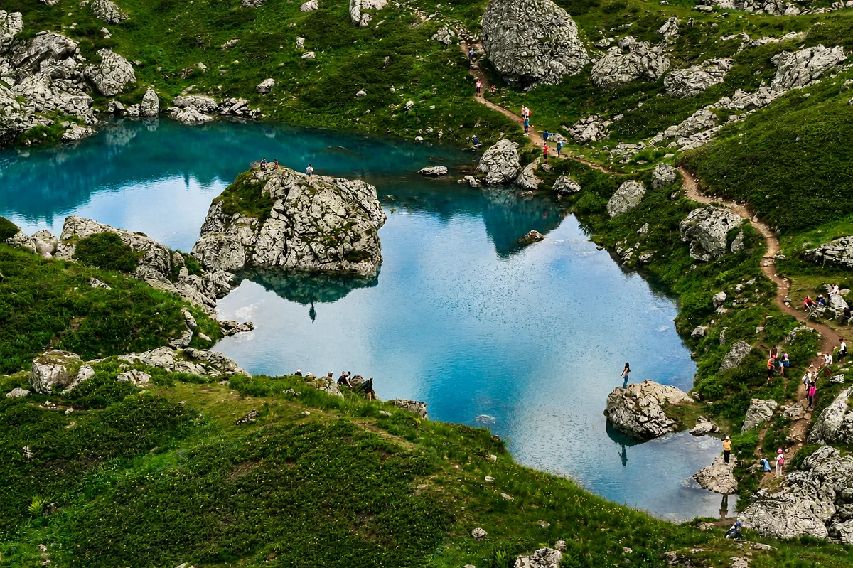
The full Juta–Roshka traverse runs about 18 to 19 kilometers and is usually done in one long day (8–10 hours) or, more comfortably, over two days. The Juta-to-Roshka direction is the one most guides recommend, since Juta sits roughly 400 meters higher and the ascent to the pass is more gradual from that side; climbing from the Roshka side is a much harder grind. From Roshka, the Abudelauri Lakes — three glacial lakes of distinctive colors (the white from glacial sediment, the blue from mineral content, the green from algae), sitting at about 2,800 meters — are among the most striking natural features in the Khevsureti highlands and form a natural endpoint or waypoint. Nearby are the Roshka Boulders, huge glacial erratics, one reaching about 11 meters. Extending the route into an Abudelauri loop (returning to Juta via the Sadzele Pass) pushes the distance up toward 25–30 kilometers and makes for a strenuous two-day circuit. The lakes are also reachable on a much easier ~6-kilometer walk directly from Roshka village (about 2,000 m) for those who don't want to cross the pass.
The village and the Khevsur people
Juta itself is small enough to walk through in minutes, but the community that maintains it — descendants of the Khevsur mountain people, whose distinct traditions, dialect, and cultural practices set them apart from the lowland Georgian mainstream — gives the place a character beyond its alpine scenery. The guesthouses are family-run, the hospitality direct and warm in the way of Georgian mountain communities, and the food — mountain cheese, freshly baked bread, meat dishes in the local tradition — has the particular quality of produce eaten close to its source, where the cold and the day's exertion make a simple meal genuinely satisfying.
Camping in the meadows around the village lets those who prefer it sleep under the Chaukhi peaks rather than under a roof, and waking in the valley at dawn — the peaks catching the first light while the meadow below is still dark and cold — is something those who've done it consistently describe as among the better mountain mornings anywhere in Georgia.
Getting there
The road from Stepantsminda to Juta branches off the main Georgian Military Highway and climbs through the Arsha valley, gaining elevation rapidly before descending to the Juta valley floor. The upper section is unpaved and requires a vehicle with good ground clearance — after rain the surface can be significantly more difficult than in dry conditions, so checking local conditions before setting out is wise. The drive takes about thirty to forty minutes from Stepantsminda. Local shared taxis from Stepantsminda serve the route and are the practical option for visitors without a suitable vehicle.
Juta is accessible from roughly late May or early June through October, the exact start of the season depending on snowmelt on the road and the upper trail sections. Peak hiking season is July and August; late June and September offer excellent conditions with fewer visitors. (Note that the Chaukhi Pass specifically opens later than the valley itself — generally not before mid-to-late June.)
Practical information
- Location: Juta valley, Kazbegi Municipality, Mtskheta-Mtianeti — about 15 km from Stepantsminda by road.
- Altitude: About 2,200 meters at the village.
- Getting there: By 4x4 or high-clearance vehicle from Stepantsminda, roughly 30–40 minutes; the upper road is unpaved. Local shared taxis available from Stepantsminda.
- Hiking: Easy valley walk to the base of the Chaukhi Massif (~8–12 km round trip); the Chaukhi Pass to Roshka is a serious ~18–19 km high-altitude trek (1 or 2 days), longer with the Abudelauri loop.
- Best season: June through October; July–August for the most reliable conditions, September for quieter trails and autumn color. The Chaukhi Pass usually opens only from mid-to-late June.
- Access: The valley and trails are freely accessible; admission is free.
Caucasus Travel FAQ
Juta is a high mountain village (about 2,200 m) in the Kazbegi district of northern Georgia, roughly 15 km from Stepantsminda by a rough mountain road. It's known as the gateway to the Chaukhi Massif — a range of pale, jagged peaks often called the "Georgian Dolomites" — and as one of Georgia's best hiking bases, with everything from an easy valley walk to the demanding Chaukhi Pass trek.
There's a range. The valley walk to the foot of the Chaukhi Massif is an easy-to-moderate day hike (about 8–12 km round trip) suitable for most fit visitors, though the 2,200 m starting altitude makes it harder than the distance suggests if you're not acclimatized. The Chaukhi Pass to Roshka is a serious high-altitude trek (about 18–19 km, 1–2 days) for experienced, well-equipped hikers.
The Chaukhi Pass (about 3,341 m) is one of the highest and most spectacular trekking passes in Georgia, crossing from Juta into the remote Khevsureti highlands. The classic Juta–Roshka trek runs roughly 18–19 km over the pass, done in one long day or two, and is best walked Juta-to-Roshka (a gentler ascent). It's usually only passable from mid-to-late June to late September, has no mobile coverage, and can be dangerous in fog — a guide is strongly recommended.
The Abudelauri Lakes are three glacial "colored" lakes at about 2,800 m on the Khevsureti side of the Chaukhi Pass — the white tinted by glacial sediment, the blue by minerals, the green by algae. They're a highlight of the Juta–Roshka trek. They can also be reached on a much easier ~6 km walk straight from Roshka village, for visitors who don't want to cross the pass. The nearby Roshka Boulders are giant glacial erratics, one about 11 m tall.
Juta is about 30–40 minutes from Stepantsminda by 4x4 or high-clearance vehicle; the upper road is unpaved and rough, especially after rain, and local shared taxis serve the route. The valley is accessible from roughly late May/June through October, with July–August the most reliable and September quieter. The Chaukhi Pass itself opens later — generally not before mid-to-late June.